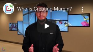
Welcome to Creating Margin

Portfolio

Check out an in-depth list of companies we have previously
worked with and the digital signage they chose to implement
into their facilities.

Home » Portfolio
Visual Portfolio, Posts & Image Gallery for WordPress

BSU Alumni Floorplan

A 3D rendered floor plan for Boise State University with blue walls, gray flooring, and text to show the specific rooms on the floor

Philips International Airport Map

A 2D map design used by the Philips International Airport featuring colorful graphics, easy-to-read-text, and an organized legend

Eastern Kentucky Floor Map

A blank 2D wayfinding floor map designed by Creating Margin

Boise State University Events & Floor Plan Screen

A 3D floor plan design integrating a live events list on the right and other floors to click and navigate to. Boxes on the bottom are also given for access to donors, school highlights, and staff directory.

Saint Louis University Floor Plan

3D rendered floor plan of the first floor at Saint Louis University. The floor plan takes advantage of a simple design using mono colors and an interactive camera rotation software

Alamo College Ground Floor

Groundfloor wayfinding map with interactive 3D rotation and room label integration

Evansville & Vanderburgh Wayfinding Screen

A wayfinding screen on an interactive device with two 3D floor plans featuring color-coded rooms and a navigation bar on the bottom, allowing visitors to access other various pages such as the news & events page, locations, find people application, and a feature that gives visitors a location on where they currently are

Wright State University Floor Plan

A green 3D floor plan of the 1st floor at Wright State University utilizing detailed room information and an interactive camera rotation software for optimal viewing angles

Flagstaff Medical College Wayfinding Map

A 2D map design with accurate wayfinding information and room location/numbers for easy pathfinding.

Hot Desk Map Design

An overhead view of a hot-desk map in a closed room to show available and taken rooms in a given office. Generally, these are rented from interactive kiosks or displays mounted in a business' headquarters.

Amsterdam Schiphol International Airport Wayfinding Screen

A 3D-rendered map of the Amsterdam Schiphol International Airport utilizing yellow labeled boxes for terminal locations and an in-depth alphabetical legend full of all the bars, restaurants, shops, and locations of the airport travelers may need

Harvest Baptist Church Wayfinding Floor Plan

A 3D floor plan of the three floors at Harvest Baptist Church with colored arrows for easy directions and local announcements for visitors to stay up to date on the latest news and events

Evansville & Vanderburgh Wayfinding Lobby

A 3D map with a list on the right of available building rooms/locations. A four box navigation bar is also on the bottom with buttons leading to other pages such as the news & events page, locations, current visitor location, and staff directory wayfinding

College of Justice & Safety Floor Plans

Four 2D, colored floor plans with a color-coded legend box on the bottom left and college logo on the top right

Eastern Kentucky All Floor Wayfinding Map

A 3D map of multiple floors of a building with numbers on each room to show specific locations and facility features showcased with a purple icon

HRP Redwood Wayfinding Map

A 3D map with yellow and grey rooms and a black box with legend information on restrooms, elevator, stairs, and general rooms

Pacific Digital Wayfinding Map

2D colored map of a business campus with color-coded legend indicators to show wayfinding directions to a specific location

Wayfinding_Blog_Graphics_Staticwayfinding-1024x687

Wayfinding_Blog_Graphics_MapwithKey-1024x687

Wayfinding_Blog_Graphics_eventlist-1024x687

Meeting Room Wayfinding

A digital signage TV display with an interactive facility wayfinding map and list of upcoming meeting time and locations

Google Map Display

A digital signage TV using Google Maps software and intuitive text box design to show information on a greenery image background

Google Map Wayfing Phone App

close-up image of someone holding a phone while using the google maps app

Digital Wayfinding App

A woman holding a phone and using a digital signage WayFinding app to get information on distance, stairs, nearby bathrooms, and more.

Wayfinding Appointment Creation

A hand holding an iPhone with a message saying "Would you like to book 134B?"

Wayfinding Campus Map

NVC Campus Map of different places uses with Wayfinding applications.

WayfindingApplications

Wayfinding Image that display Today's Events along with block structure of areas.

How Can Wayfinding Help You

How Can Wayfinding Help You image display various work area and icons that helps in easy navigation for everyone.

Have Additional Questions That Need Answering?

We'll get back to you as soon as we can.